
Categories
southbay neighborhood guidesPublished October 30, 2026
Living in Rancho Palos Verdes, CA: The Complete Guide

By Frank Kenny, REALTOR® (DRE #01250123) · Frank Kenny Real Estate Team, eXp Realty of Greater Los Angeles · Updated October 2026
Rancho Palos Verdes is the largest city on the Palos Verdes Peninsula, a coastal, mostly single-family suburb of about 40,000 people with miles of ocean bluffs, the Terranea resort, a 1,400-acre nature preserve and top-rated public schools, plus one serious risk buyers must understand: the Greater Portuguese Bend landslide. Most of the city is far from the slide, but every buyer here should know where it is and what it has done since 2023.
I've sold homes in the South Bay since 1998. This guide covers what life in Rancho Palos Verdes (most people say "RPV") is like, the neighborhoods, prices, schools and commute, and a dated, sourced summary of the landslide, the utility shutoffs and the buyout program.
Rancho Palos Verdes at a Glance
| Fact | Rancho Palos Verdes |
|---|---|
| Population | 42,287 (2020 Census); 39,654 (Census estimate, July 2025) |
| Incorporated | September 7, 1973 |
| Land area | 13.47 square miles |
| ZIP code | 90275 |
| School district | Palos Verdes Peninsula Unified (Niche: A+, #3 of 465 California districts, checked October 2026); Eastview families can choose PVPUSD or LAUSD |
| Distance to LAX | About 16 miles by car from City Hall |
| Distance to downtown LA | About 30 miles by car |
| Typical homes | Single-family view homes, ranch-style tracts, some townhomes and condos |
| Owner-occupied homes | 80.4% (ACS 2020–2024) |
| Market snapshot | Median sale price about $1.76M, three months ending September 2026, down 2.3% year over year (Redfin) |
What Is It Like to Live in Rancho Palos Verdes?
Living in Rancho Palos Verdes means hillside streets, ocean views, and quick access to trails and coastline, with most shopping and dining just over the border in Rolling Hills Estates, Torrance and San Pedro. It's the newest of the four Peninsula cities, incorporated in 1973, and by far the largest, covering 13.47 square miles from the Palos Verdes Estates border to San Pedro.
The city borders Palos Verdes Estates, Rolling Hills, Rolling Hills Estates, Torrance and the Los Angeles neighborhoods of San Pedro and Harbor City. The biggest local employers, according to the city's 2024 financial report, are the Palos Verdes Peninsula Unified School District (1,425 jobs), Terranea Resort (638), the Salvation Army (263) and the UCLA South Bay campus (215), which replaced Marymount California University after it closed in 2022.
What Are the Neighborhoods in Rancho Palos Verdes?
Rancho Palos Verdes is a collection of distinct neighborhoods, and the differences between them matter more here than in most South Bay cities.
- Eastview: the northeast side near San Pedro and Harbor City, where children can attend either Palos Verdes Peninsula Unified or LAUSD schools. A 1992 vote to move the LAUSD portion to PVPUSD was blocked in court.
- Miraleste: the wooded east side, home to Miraleste Intermediate School. It's one of the areas covered by the Palos Verdes Homes Association's Art Jury, so exterior changes need design review.
- Silver Spur and the central hills: the area around Silver Spur Road and Hawthorne Boulevard near the Rolling Hills Estates border, close to Peninsula Center shopping.
- The west coast (Palos Verdes Drive West): ocean-view homes near Point Vicente Lighthouse and Terranea.
- Portuguese Bend and Seaview: coastal neighborhoods off Palos Verdes Drive South, inside the active landslide area (see below).
- Abalone Cove and the Portuguese Bend Beach Club: oceanfront areas at the bottom of the landslide complex.
- Trump National area: homes on lots next to the golf course on the south coast, toward San Pedro.
What Kind of Homes Are in Rancho Palos Verdes, and What Do They Cost?
Most Rancho Palos Verdes homes are single-family houses, and Redfin reports a median sale price of about $1.76 million ($1,758,163) for the three months ending September 2026, down 2.3% from a year earlier. Homes sold in about 45 days on average and received about two offers each.
That median is lower than in Palos Verdes Estates (about $2.9 million) and Rolling Hills Estates (about $2.3 million) over the same period, partly because RPV is much bigger and has a wider mix of homes, lot sizes and views. The Census Bureau puts the owner-occupancy rate at 80.4%, lower than in its Peninsula neighbors, which means more of RPV's homes are rentals. Location inside the city matters a lot. An ocean-view home on the west side and a house near the landslide on Palos Verdes Drive South aren't the same market, even if they share a ZIP code.
What Are the Schools Like?
Most of Rancho Palos Verdes is served by the Palos Verdes Peninsula Unified School District, which Niche gives an A+ overall grade and ranks #3 of 465 districts in California (checked October 2026). Niche reports 10,177 students and a 22-to-1 student-teacher ratio.
PVPUSD's two comprehensive high schools are Palos Verdes Peninsula High School and Palos Verdes High School. Two of its three intermediate schools, Miraleste and Ridgecrest, serve RPV neighborhoods. The boundary quirk to know is Eastview: some homes there are in LAUSD territory, with the option to attend PVPUSD. Confirm school assignment for the exact address with the district before you buy.
What Is There to Do in Rancho Palos Verdes?
Rancho Palos Verdes is the Peninsula's outdoor city, with most of its open coastline, its biggest preserve and its two best-known destinations.
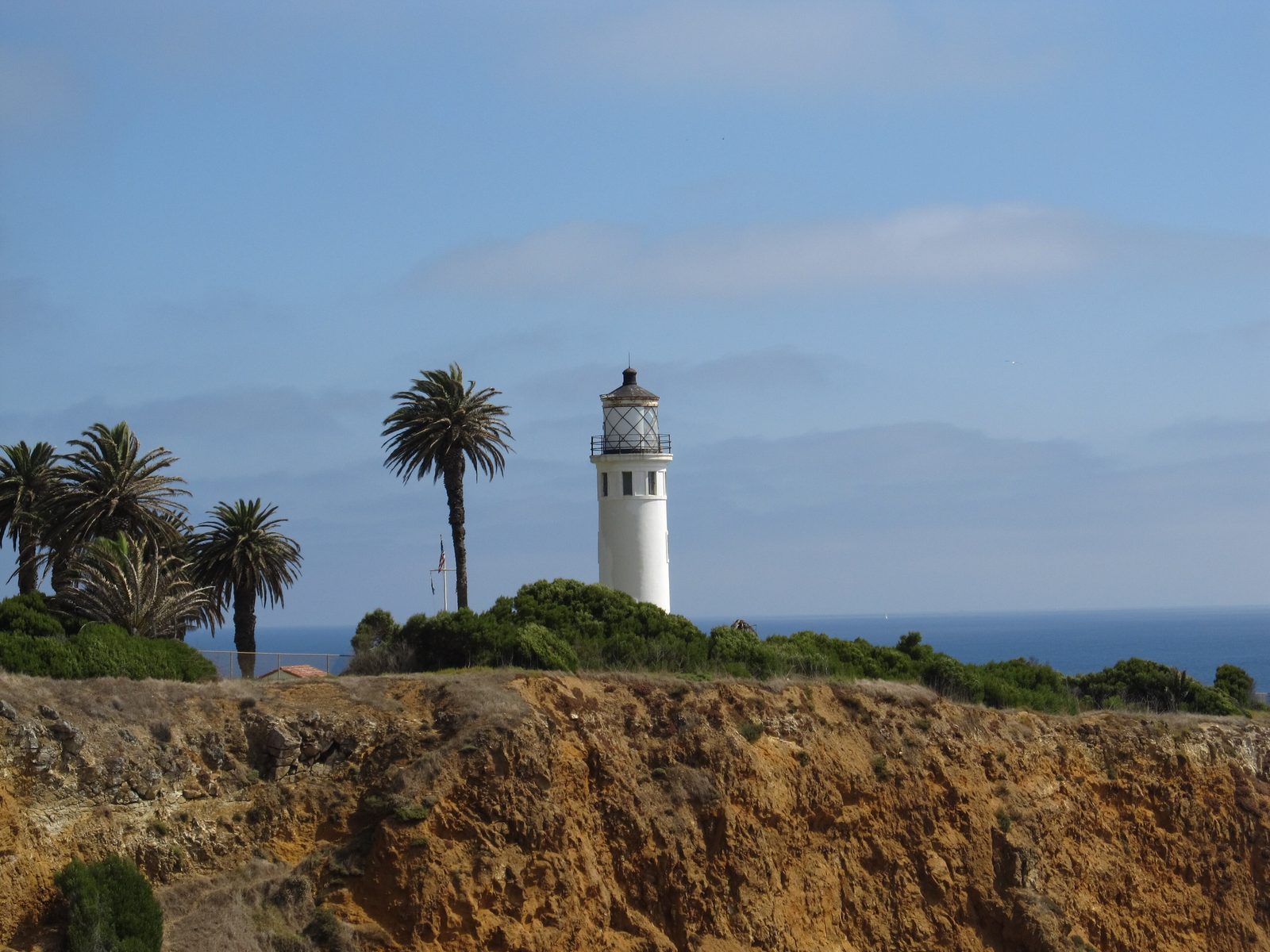
Point Vicente Lighthouse on the Rancho Palos Verdes coast. Photo: Ken Lund from Reno, Nevada, USA, CC BY-SA 2.0, via Wikimedia Commons
- Palos Verdes Nature Preserve: about 1,400 acres of city-owned open space, co-managed by the Palos Verdes Peninsula Land Conservancy, with hiking, biking and equestrian trails. The Portuguese Bend Reserve is the largest piece at 424 acres.
- Terranea Resort: a 102-acre oceanfront resort that opened on June 12, 2009, on the former site of Marineland of the Pacific.
- Trump National Golf Club Los Angeles: originally Ocean Trails. A landslide on June 2, 1999, sent its 18th hole toward the ocean before the course opened. Donald Trump bought it in 2002 for $27 million, and it reopened in 2006.
- Point Vicente Lighthouse: built in 1926 and listed on the National Register of Historic Places.
- Wayfarers Chapel: the Lloyd Wright glass chapel was taken apart and stored in 2024 because of land movement. A plan announced in May 2025 would rebuild it about a mile away at the Battery Barnes site, pending a federal land transfer.
How Is the Commute from Rancho Palos Verdes?
Rancho Palos Verdes is about 16 miles from LAX and about 30 miles from downtown Los Angeles by car (Google Maps, shortest suggested route from City Hall). No freeway or Metro rail line reaches the Peninsula, so drivers use Hawthorne Boulevard, Western Avenue, Crenshaw Boulevard and the Palos Verdes Drives to reach the 405 or the 110.
The Census Bureau puts the average commute at 32.8 minutes. The Palos Verdes Peninsula Transit Authority runs local buses. One more commute note: the stretch of Palos Verdes Drive South through the landslide has needed repeated repairs. In October 2026, the city applied for a $3 million federal grant to design a reconstruction of about two miles of the road, a project it estimates at $28 million in total.
What Should Buyers Know About the Portuguese Bend Landslide?
The Greater Portuguese Bend Landslide Complex is an ancient, slow-moving landslide on RPV's south coast that sped up sharply in 2023 and 2024, damaging homes and roads and leading to long-term utility shutoffs and a federal buyout program. Here's the timeline from the city's own updates and news reports.
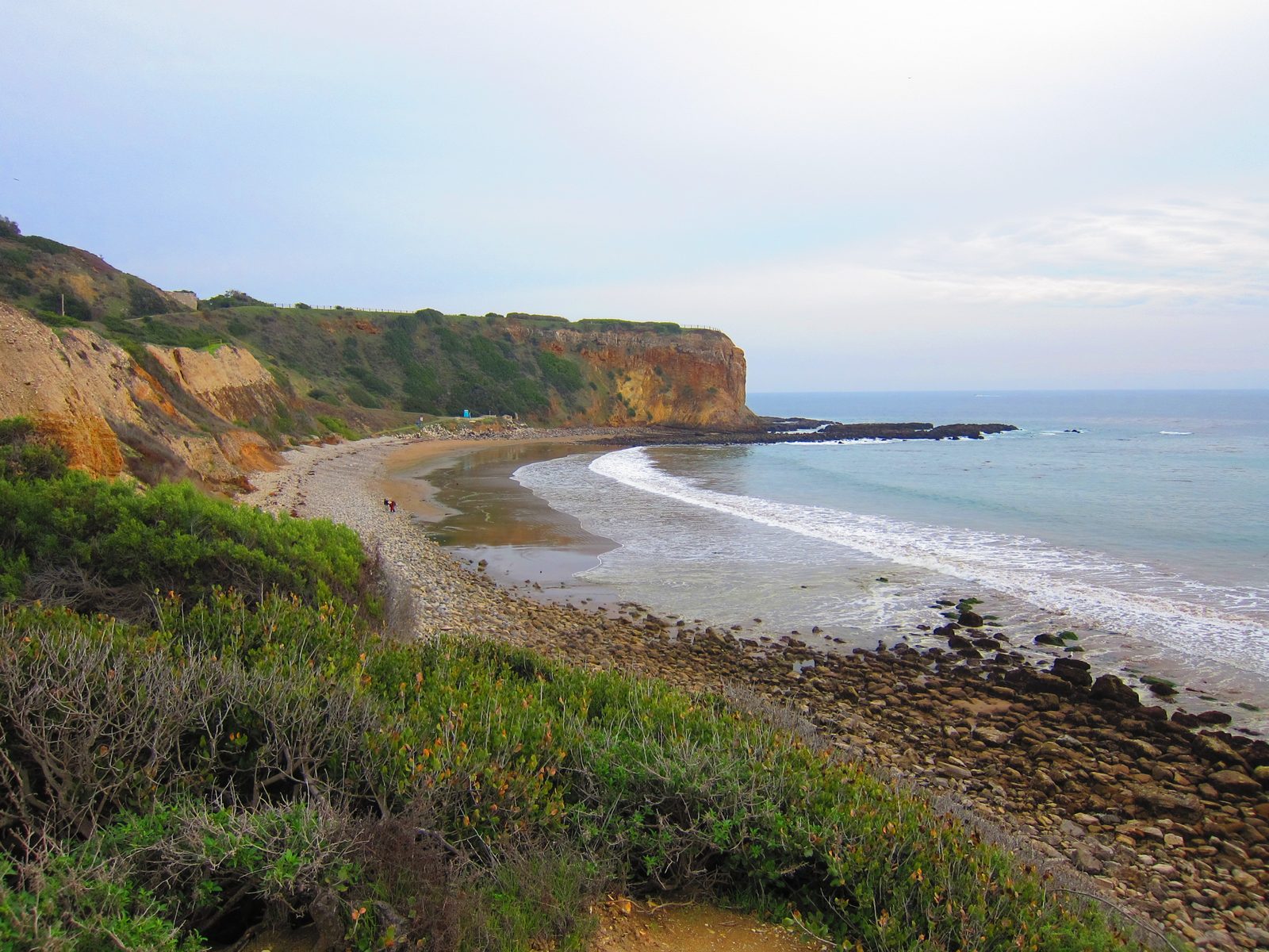
Abalone Cove in the Portuguese Bend area of Rancho Palos Verdes. Photo: Jim Helvey, CC BY 3.0, via Wikimedia Commons
- Size: In December 2024, LAist reported that city staff now map the complex at about 700 acres, up from 380 acres. That's roughly 8% of the city's land area.
- October 2023: the city declared a local emergency and put a building moratorium on the landslide area.
- Early September 2024: the city reported average movement of about 8 inches a week, 80 times faster than in October 2022.
- September 1–6, 2024: Southern California Edison cut power indefinitely to parts of the Portuguese Bend Community Association and Seaview, and SoCalGas shut off gas to homes in western Seaview and the Portuguese Bend Beach Club. Governor Newsom declared a state of emergency on September 3.
- October 28, 2024: FEMA and Cal OES announced a $42 million voluntary buyout. Homes are bought at pre-disaster fair market value, FEMA covers 75% and the owner's share is 25%, and the land becomes permanent open space. The city received 85 applications.
- December 2024: movement had slowed to about 2.7 inches a week after the city drilled deep dewatering wells.
- August 26, 2026: power was back on in Seaview and the Portuguese Bend Beach Club, but the Portuguese Bend Community Association neighborhood was still without SCE power. SCE says it needs movement to stay under 1 inch a week near its lines.
- September 2026: the citywide average fell below 1 inch a week (0.99) for the first time since October 2023.
- October 14, 2026: FEMA formally awarded more than $54 million for the first two buyout rounds, covering 27 homes. A third round is waitlisted. As of October 28, no homes had been purchased yet, and the city expects buying all 27 to take a few years.
- October 28, 2026: early-October readings averaged 1.05 inches a week, about 30% slower than a year earlier.
What this means for a buyer: if a home is in or near Portuguese Bend, Seaview, Abalone Cove or the Beach Club, read the city's land movement updates, ask about utility status and permits under the moratorium, and hire a geotechnical engineer. Standard homeowners policies generally don't cover earth movement, and the city's own FAQ says land movement damage usually isn't covered.
What Else Should Buyers Know Before Buying in Rancho Palos Verdes?
Beyond the landslide, Rancho Palos Verdes buyers should check fire zones, insurance and the property tax bill.
Fire hazard severity zones
The State Fire Marshal sent the city updated fire hazard severity zone maps on March 24, 2025, and the city says RPV has a combination of Moderate, High and Very High zones. City staff recommended adopting the new map by ordinance in July 2025, taking effect January 1, 2026. Check a specific address on the State Fire Marshal's map viewer, since the zone affects defensible-space rules, remodel standards and disclosures.
Homeowners insurance
Get a quote before you remove contingencies. On September 18, 2026, the California Department of Insurance reported that State Farm and Allstate had filed to start writing new homeowners policies again, but said "these companies are not open for new business yet." The California FAIR Plan is the last resort, and it mainly covers fire.
Taxes
Your property tax starts at the 1% base on your purchase price plus voter-approved bonds and assessments, and a supplemental bill arrives after closing. RPV has no city transfer tax. The LA County documentary transfer tax is $1.10 per $1,000.
Pros and Cons of Living in Rancho Palos Verdes
Pros
- Miles of coastline, a 1,400-acre nature preserve and Terranea
- An A+ school district on Niche
- More price range than the other Peninsula cities, with a median near $1.76 million
- Quiet residential streets with ocean and city views
Cons
- An active landslide in the south coast neighborhoods, with damage, utility shutoffs and road repairs since 2023
- Fire hazard zones and a hard insurance market
- About 16 miles to LAX and no freeway or rail on the Peninsula
- Limited shopping and dining inside city limits
Who Is Rancho Palos Verdes Best For?
Rancho Palos Verdes is best for buyers who want Peninsula schools, ocean views and trail access at a lower median price than Palos Verdes Estates or Rolling Hills Estates, and who are willing to do real due diligence on geology and insurance. It works well for families, hikers and people who work from home or commute at off-peak hours. It's a harder fit for buyers who need a short daily freeway commute, or who aren't comfortable with land movement risk anywhere nearby.
Looking at Rancho Palos Verdes? Search homes for sale, read our South Bay buyer's guide, or talk to our team about a specific neighborhood. If you own in RPV and are thinking about selling, start with our seller's guide.
This guide is general information, not legal, tax, insurance or engineering advice. Landslide conditions, buyout status, fire maps and insurer availability change, so check the City of Rancho Palos Verdes land movement updates and consult qualified professionals about any specific property.
Frequently Asked Questions
Is all of Rancho Palos Verdes affected by the landslide?
No. The Greater Portuguese Bend Landslide Complex covers about 700 acres on the city's south coast, roughly 8% of its land, including Portuguese Bend, Seaview, Abalone Cove and the Portuguese Bend Beach Club. Most RPV neighborhoods are outside it, but buyers anywhere in the city should still review geology reports.
Is the Rancho Palos Verdes landslide still moving in 2026?
Yes, but more slowly. The city reported an average of 1.05 inches a week in early October 2026, about 30% slower than a year earlier, after peaking around 8 inches a week in September 2024. In September 2026, the average fell below 1 inch a week for the first time since October 2023.
What is the Rancho Palos Verdes buyout program?
It's a voluntary FEMA-funded program that buys landslide-damaged homes at pre-disaster fair market value and turns the land into permanent open space. In October 2026, FEMA formally awarded more than $54 million for 27 homes in two rounds. The city said no purchases had closed as of late October 2026.
Do homes in Rancho Palos Verdes still lack power or gas?
Some do. As of the city's August 26, 2026 update, power had been restored in Seaview and the Portuguese Bend Beach Club, but the Portuguese Bend Community Association neighborhood was still without SCE power. Check the city's land movement updates for the latest status.
What school district is Rancho Palos Verdes in?
Most of Rancho Palos Verdes is in the Palos Verdes Peninsula Unified School District, which Niche grades A+ and ranks #3 of 465 California districts (checked October 2026). In the Eastview neighborhood, some families can choose between PVPUSD and LAUSD.
Is Terranea in Rancho Palos Verdes?
Yes. Terranea Resort is a 102-acre oceanfront resort in Rancho Palos Verdes that opened in 2009 on the site of the former Marineland of the Pacific. It's also one of the city's largest employers, with 638 jobs in the city's 2024 report.
Featured image photo: Jim Helvey, CC BY 3.0, via Wikimedia Commons, cropped and edited with added text.
or another way